


 Comprehensive weather insights help safeguard your operations and drive confident decisions to make everyday mining operations as safe and efficient as possible.
 Learn how to optimize operations with credible weather and environmental intelligence. From aviation safety to environmental compliance, our comprehensive suite of solutions delivers real-time insights, advanced forecasting, and precise monitoring capabilities.
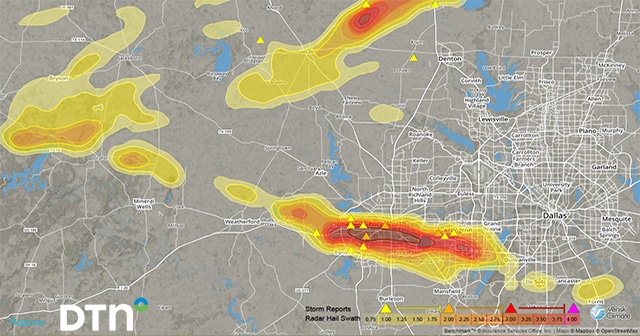
 Today’s marriage of advanced weather information and analytics, along with ever-evolving mapping abilities, produces capabilities once unimaginable. It’s now possible—from the comfort and convenience of any computer or smart device—to “see” golf ball-size hail descending upon on a rural intersection, to identify specific geographic areas under the gun for heavy precipitation, or to determine whether
Hi-Res GIS Weather Layers Are Essential to Business and Government