


 Comprehensive weather insights help safeguard your operations and drive confident decisions to make everyday mining operations as safe and efficient as possible.
 Learn how to optimize operations with credible weather and environmental intelligence. From aviation safety to environmental compliance, our comprehensive suite of solutions delivers real-time insights, advanced forecasting, and precise monitoring capabilities.
 Precipitation is arguably the most important agricultural weather parameter, yet it is the most difficult variable to precisely measure.
The Precipitation Problem In Agriculture
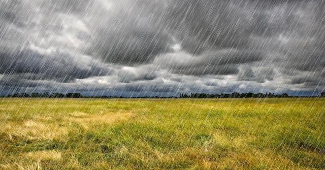
Precipitation is arguably the most important agricultural weather parameter, yet it is the most difficult variable to precisely measure.

Stewart Williams @pgawxman1 University of North Carolina at Asheville, Meteorology On-site event meteorologist for professional golf Has been with DTN for 12 years What is your favorite part about being in MetOps? Working with a great group of people that have the same passion for weather as I do. What is the craziest weather event
With the vernal equinox now behind us, spring has officially arrived in the astronomical sense.
In basic terms, the two things needed for precipitation are moisture and lift. Temperature profiles and landmasses can also affect how much rain a region gets. Mountains can have a significant effect on rainfall. When air reaches the mountains, it is forced to rise over this barrier. As the air moves up the windward side of

Aaron Studwell @RaceWeather University of Michigan, B.S. Aerospace Engineering Texas A&M University, M.S. Meteorology University of Houston, Ph.D. (candidate) Atmospheric Sciences DTN Marine Team Lead Has been with DTN 8 months with the acquisition of Wilkens Weather Technologies (7.5 years) What is your favorite part about being in MetOps? Working with and mentoring my direct

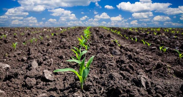
Iteris has just released version 3.0 of WeatherPlot®, the location-specific, agriculturally focused weather and soil decision support tool for agronomists, researchers, and crop science professionals who manage product performance inquiries.

Tanner Verstegen @VerstegenWX University of Wisconsin-Madison – Atmospheric and Oceanic Sciences DTN Energy Meteorologist Has been with DTN for 2.5 years How did you end up working at DTN? Heard about DTN at a conference and was thrilled with the variety of clients they serve, looked like an exciting place to spend my days. What

Cody Fishman @cody_fish21 Florida International University in Miami, FL – B.S. in Geoscience with a concentration in Atmospheric Science DTN Energy Meteorologist Has been with DTN for 2 years How did you end up working at DTN? I would email the DTN Meteorology Director occasionally asking about new job postings, and I also met with

Wade Stettner @wadestettner University of North Dakota – Atmospheric Sciences Meteorologist – Sports & Rec Team Lead Has been with DTN since March 2000 What is your favorite part about being in MetOps? Working with the PGA Tour and LPGA. What is the most challenging part of being in MetOps? Dealing with the local weather
Have you ever seen a weather map and wondered what the symbols on it meant? Surface maps are great tools for getting a quick look at weather conditions. They allow meteorologists to gain a wealth of information about the weather at a glance by viewing the various symbols. The origin of some weather symbols, such